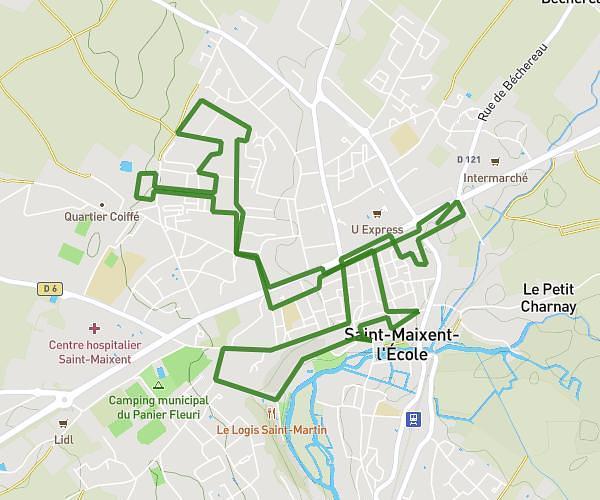
This running route covers 4.198mi starting from Saint-Maixent-l'École, Deux-Sèvres. The run does not return to the trailhead and ends near Rue De La Carrée, 79400 Saint-Maixent-l'École, France. This run is rated as easy, expect about 45m to complete it. The route has an elevation gain of 305ft and an elevation loss of 253ft.
Église exireuil
Route details
5.6mph
Speed
515 kcal
Calories burned
Point to point
Route type
220ft
Min altitude
489ft
Max altitude
Route profile
305ft
Elevation gain
253ft
Elevation loss
220ft
Min altitude
489ft
Max altitude
How to get there
Trailhead: 10 Rue Aristide Briand, 79400 Saint-Maixent-l'École, France
GPS coordinates of the trailhead: 46.41338, -0.21082 / 46°24'48'' N, 0°12'38'' W