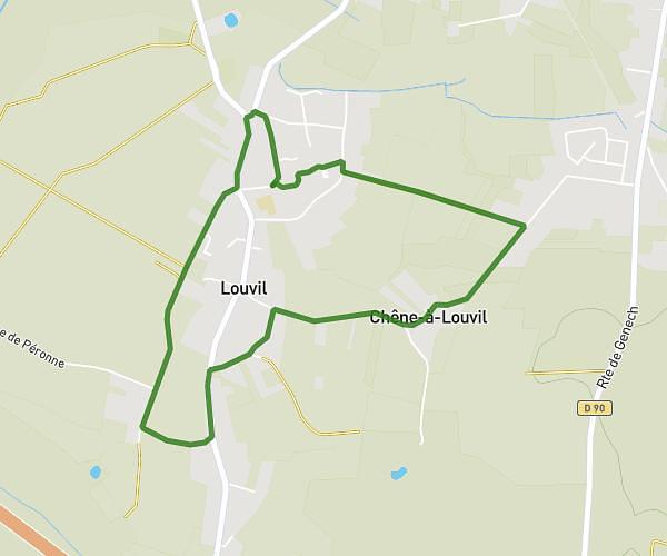
This running route covers 7.563mi starting from Raismes, Nord. The run is a loop trail and returns to the trailhead. This run is rated as hard, expect about 1h30m to complete it. The route has an elevation gain of 174ft and an elevation loss of 167ft.
Entrainement Moyen Trail Raismes
Route details
5.04mph
Speed
1029 kcal
Calories burned
Loop trail
Route type
49ft
Min altitude
207ft
Max altitude
Route profile
174ft
Elevation gain
167ft
Elevation loss
49ft
Min altitude
207ft
Max altitude
How to get there
Trailhead: Étoile De La Princesse, 59590 Raismes
GPS coordinates of the trailhead: 50.40142, 3.48725 / 50°24'5'' N, 3°29'14'' E