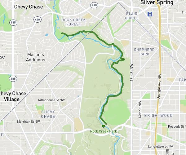
This hiking trail covers 2.832mi starting from Rockville, Maryland. The hike is a loop trail and returns to the trailhead. This hike is rated as easy, plan for about 1h43m to complete it. The route has an elevation gain of 200ft and an elevation loss of 200ft.
Lake Frank
Route details
1.65mph
Speed
737 kcal
Calories burned
2.7%
Avg grade
Loop trail
Route type
289ft
Min altitude
387ft
Max altitude
Route profile
200ft
Elevation gain
200ft
Elevation loss
289ft
Min altitude
387ft
Max altitude
How to get there
Trailhead: Bauer Drive, 20853 Rockville
GPS coordinates of the trailhead: 39.09601, -77.10832 / 39°5'45'' N, 77°6'29'' W