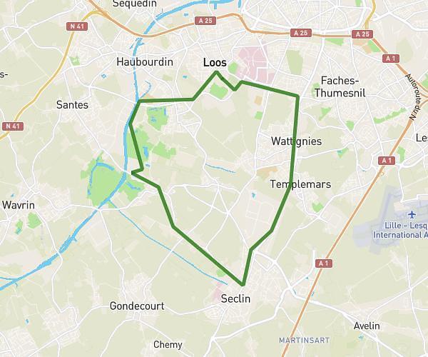
This running route covers 6.165mi starting from Lille, Nord. The run does not return to the trailhead and ends near 3 Rue D'armentières, 59000 Lille, France. This run is rated as moderate, expect about 1h to complete it. The route has an elevation gain of 10ft and an elevation loss of 10ft.
10km lille
Route details
6.16mph
Speed
686 kcal
Calories burned
Point to point
Route type
62ft
Min altitude
72ft
Max altitude
Route profile
10ft
Elevation gain
10ft
Elevation loss
62ft
Min altitude
72ft
Max altitude
How to get there
Trailhead: 18 Avenue De L'architecte Louis Cordonnier, 59000 Lille, France
GPS coordinates of the trailhead: 50.634831, 3.042967 / 50°38'5'' N, 3°2'34'' E