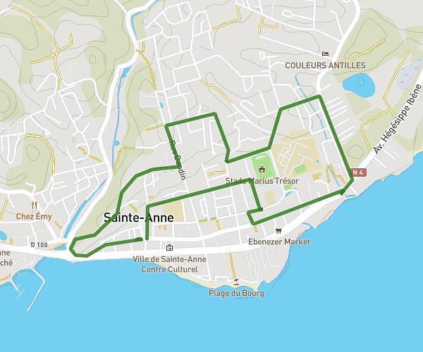
This running route covers 4.87mi starting from Saint-François, Guadeloupe. The run does not return to the trailhead and ends near 10 Chemin De La Coulée, 97118, Saint-François, Guadeloupe. This run is rated as easy, expect about 52m1s to complete it. The route has an elevation gain of 197ft and an elevation loss of 197ft.
Pointe des châteaux
Route details
5.62mph
Speed
595 kcal
Calories burned
Point to point
Route type
0ft
Min altitude
43ft
Max altitude
Route profile
197ft
Elevation gain
197ft
Elevation loss
0ft
Min altitude
43ft
Max altitude
How to get there
Trailhead: Route De La Pointe-Des-Châteaux, 97118, Saint-François, Guadeloupe
GPS coordinates of the trailhead: 16.247627, -61.178067 / 16°14'51'' N, 61°10'41'' W