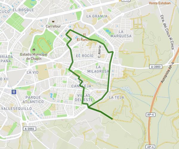
This running route covers 6.09mi starting from Jerez de la Frontera, Cádiz. The run is a loop trail and returns to the trailhead. This run is rated as moderate, expect about 41m to complete it. The route has an elevation gain of 121ft and an elevation loss of 115ft.
hipercor pozoalbero
Route details
8.91mph
Speed
469 kcal
Calories burned
Loop trail
Route type
138ft
Min altitude
259ft
Max altitude
Route profile
121ft
Elevation gain
115ft
Elevation loss
138ft
Min altitude
259ft
Max altitude
How to get there
Trailhead: Calle Maestro Álvarez Beigbeder 13, 11407 Jerez de la Frontera, Cádiz, Spain
GPS coordinates of the trailhead: 36.69824, -6.14071 / 36°41'53'' N, 6°8'26'' W