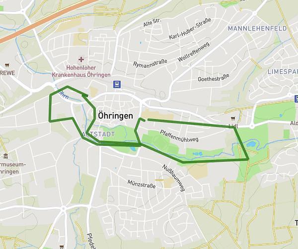
This running route covers 3.612mi starting from Öhringen, Baden-Württemberg. The run is a loop trail and returns to the trailhead. This run is rated as easy, expect about 38m45s to complete it. The route has an elevation gain of 279ft and an elevation loss of 279ft.
Probieren
Route details
5.59mph
Speed
443 kcal
Calories burned
Loop trail
Route type
722ft
Min altitude
787ft
Max altitude
Route profile
279ft
Elevation gain
279ft
Elevation loss
722ft
Min altitude
787ft
Max altitude
How to get there
Trailhead: Weygangstraße 4, 74613 Öhringen, Germany
GPS coordinates of the trailhead: 49.200075, 9.506299 / 49°12'0'' N, 9°30'22'' E