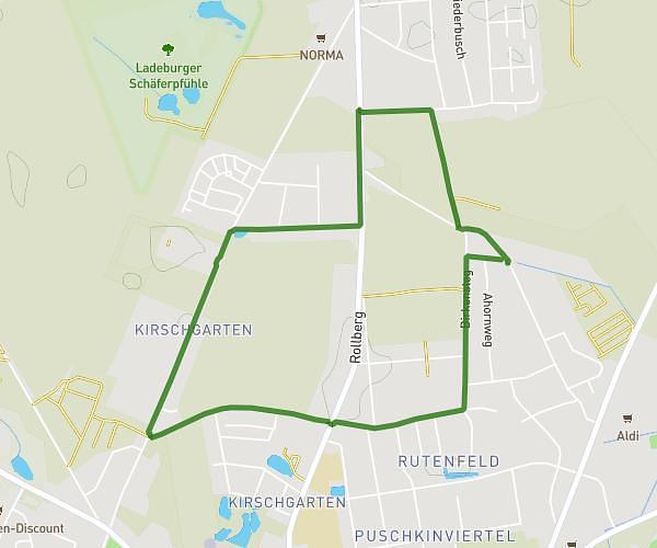
This running route covers 4.183mi starting from Rüdersdorf bei Berlin, Brandenburg. The run is a loop trail and returns to the trailhead. This run is rated as easy, expect about 43m45s to complete it. The route has an elevation gain of 335ft and an elevation loss of 335ft.
Abendrunde
Route details
5.74mph
Speed
500 kcal
Calories burned
Loop trail
Route type
115ft
Min altitude
226ft
Max altitude
Route profile
335ft
Elevation gain
335ft
Elevation loss
115ft
Min altitude
226ft
Max altitude
How to get there
Trailhead: Santoker Straße 107, 15562 Rüdersdorf bei Berlin, Germany
GPS coordinates of the trailhead: 52.462421, 13.799992 / 52°27'44'' N, 13°47'59'' E