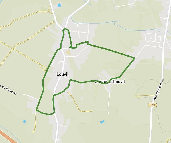
This running route covers 3.342mi starting from Templeuve-en-Pévèle, Nord. The run is a loop trail and returns to the trailhead. This run is rated as easy, expect about 45m to complete it. The route has an elevation gain of 171ft and an elevation loss of 171ft.
Numéro 2
Route details
4.46mph
Speed
515 kcal
Calories burned
Loop trail
Route type
95ft
Min altitude
174ft
Max altitude
Route profile
171ft
Elevation gain
171ft
Elevation loss
95ft
Min altitude
174ft
Max altitude
How to get there
Trailhead: 86 Rue De La Grande Campagne, 59242 Templeuve-en-Pévèle, France
GPS coordinates of the trailhead: 50.52248, 3.17507 / 50°31'20'' N, 3°10'30'' E