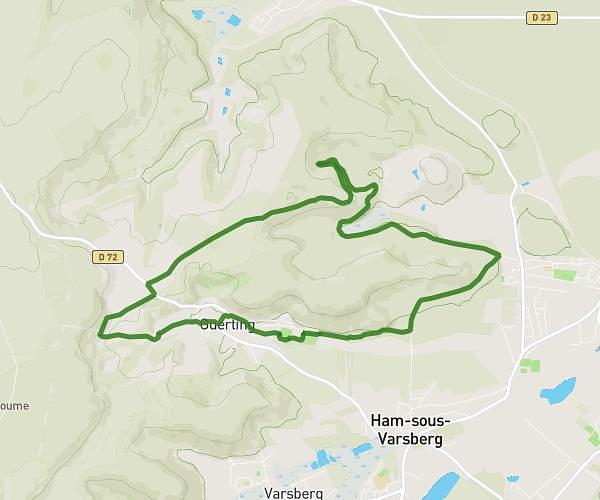
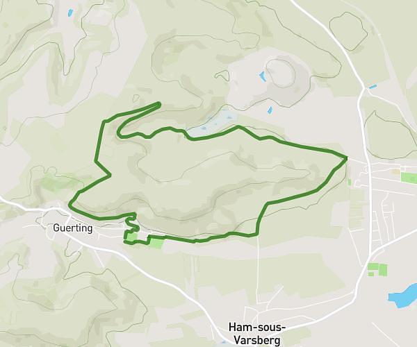
This walking route covers 4.892mi starting from Guerting, Moselle. The walk is a loop trail and returns to the trailhead. This walk is rated as moderate, plan for about 1h45m to complete it. The route has an elevation gain of 581ft and an elevation loss of 584ft.
Marche Guerting en fête
Route details
21:27/mi
Pace
429 kcal
Calories burned
Loop trail
Route type
784ft
Min altitude
1112ft
Max altitude
Route profile
581ft
Elevation gain
584ft
Elevation loss
784ft
Min altitude
1112ft
Max altitude
How to get there
Trailhead: Rue De L'ancien Ranch, 57880 Guerting
GPS coordinates of the trailhead: 49.18791, 6.63148 / 49°11'16'' N, 6°37'53'' E