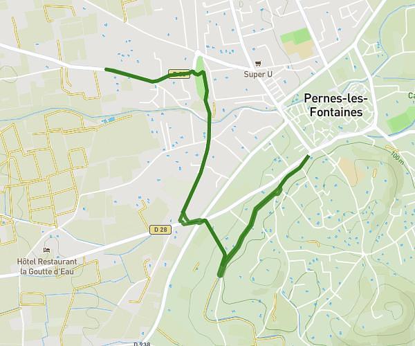
This walking route covers 3.875mi starting from Gargas, Vaucluse. The walk is a loop trail and returns to the trailhead. This walk is rated as moderate, plan for about 1h23m to complete it. The route has an elevation gain of 108ft and an elevation loss of 105ft.
vers Les Andéols
Route details
21:25/mi
Pace
339 kcal
Calories burned
Loop trail
Route type
840ft
Min altitude
945ft
Max altitude
Route profile
108ft
Elevation gain
105ft
Elevation loss
840ft
Min altitude
945ft
Max altitude
How to get there
Trailhead: 314 Avenue Des Lombards, 84400 Gargas, France
GPS coordinates of the trailhead: 43.91518, 5.33803 / 43°54'54'' N, 5°20'16'' E