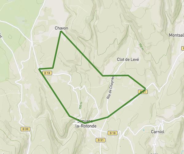
This walking route covers 8.838mi starting from Castellet-en-Luberon, Vaucluse. The walk is a loop trail and returns to the trailhead. This walk is rated as strenuous, plan for about 3h34m to complete it. The route has an elevation gain of 1280ft and an elevation loss of 1280ft.
Balade 2 janvier?
Route details
24:12/mi
Pace
874 kcal
Calories burned
Loop trail
Route type
1453ft
Min altitude
2083ft
Max altitude
Route profile
1280ft
Elevation gain
1280ft
Elevation loss
1453ft
Min altitude
2083ft
Max altitude
How to get there
Trailhead: 2 Chemin De La Combe, 84400 Castellet-en-Luberon, France
GPS coordinates of the trailhead: 43.837825, 5.477638 / 43°50'16'' N, 5°28'39'' E