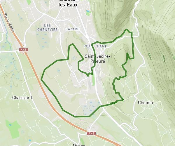
This running route covers 4.465mi starting from Saint-Jeoire-Prieuré, Savoie. The run is a loop trail and returns to the trailhead. This run is rated as easy, expect about 41m to complete it. The route has an elevation gain of 138ft and an elevation loss of 20ft.
Challes Ls Eaux
Route details
6.54mph
Speed
469 kcal
Calories burned
Loop trail
Route type
1014ft
Min altitude
1152ft
Max altitude
Route profile
138ft
Elevation gain
20ft
Elevation loss
1014ft
Min altitude
1152ft
Max altitude
How to get there
Trailhead: 73 Chemin De La Genote, 73190 Saint-Jeoire-Prieuré, France
GPS coordinates of the trailhead: 45.52683, 5.988654 / 45°31'36'' N, 5°59'19'' E