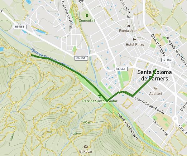
This hiking trail covers 1.62mi starting from Santa Coloma de Farners, Girona. The hike is a loop trail and returns to the trailhead. This hike is rated as easy, plan for about 35m to complete it. The route has an elevation gain of 112ft and an elevation loss of 112ft.
Pont
Route details
2.78mph
Speed
250 kcal
Calories burned
2.6%
Avg grade
Loop trail
Route type
436ft
Min altitude
469ft
Max altitude
Route profile
112ft
Elevation gain
112ft
Elevation loss
436ft
Min altitude
469ft
Max altitude
How to get there
Trailhead: Carrer Sant Ignasi 10, 17430 Santa Coloma de Farners, Girona, Spain
GPS coordinates of the trailhead: 41.860838, 2.666034 / 41°51'39'' N, 2°39'57'' E