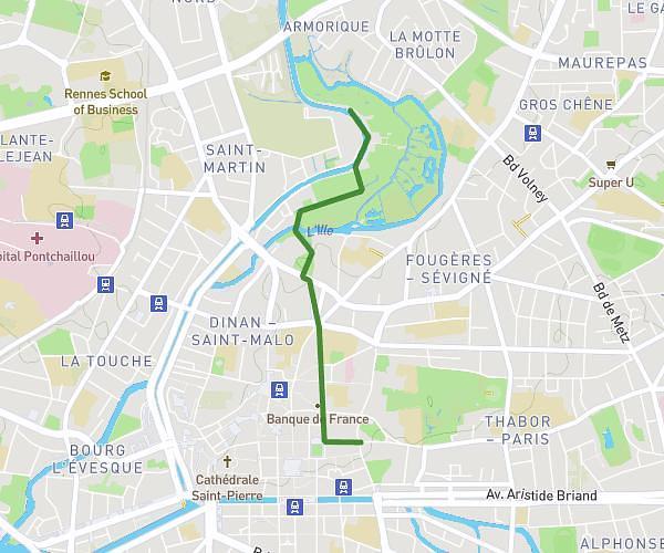
This running route covers 3.205mi starting from Rennes, Ille-et-Vilaine. The run does not return to the trailhead and ends near 46 Canal Saint-Martin, 35000 Rennes, France. This run is rated as easy, expect about 34m to complete it. The route has an elevation gain of 26ft and an elevation loss of 10ft.
Course apimed 2025
Route details
5.65mph
Speed
389 kcal
Calories burned
Point to point
Route type
75ft
Min altitude
92ft
Max altitude
Route profile
26ft
Elevation gain
10ft
Elevation loss
75ft
Min altitude
92ft
Max altitude
How to get there
Trailhead: 20 Avenue Jules Ferry, 35700 Rennes, France
GPS coordinates of the trailhead: 48.118455, -1.67059 / 48°7'6'' N, 1°40'14'' W