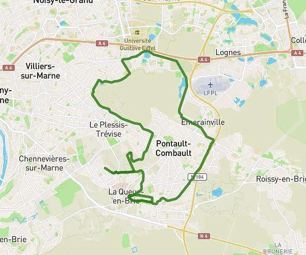
This running route covers 6.698mi starting from Ivry-sur-Seine, Val-de-Marne. The run is a loop trail and returns to the trailhead. This run is rated as moderate, expect about 1h5m to complete it. The route has an elevation gain of 26ft and an elevation loss of 33ft.
10km vitry
Route details
6.18mph
Speed
743 kcal
Calories burned
Loop trail
Route type
200ft
Min altitude
223ft
Max altitude
Route profile
26ft
Elevation gain
33ft
Elevation loss
200ft
Min altitude
223ft
Max altitude
How to get there
Trailhead: 46 Rue René Villars, 94200 Ivry-sur-Seine, France
GPS coordinates of the trailhead: 48.81847, 2.3762 / 48°49'6'' N, 2°22'34'' E