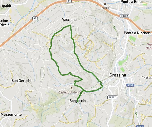
This walking route covers 3.268mi starting from Montespertoli, Florence. The walk is a loop trail and returns to the trailhead. This walk is rated as moderate, plan for about 30m to complete it. The route has an elevation gain of 331ft and an elevation loss of 331ft.
Ludico motoria
Route details
9:11/mi
Pace
123 kcal
Calories burned
Loop trail
Route type
686ft
Min altitude
840ft
Max altitude
Route profile
331ft
Elevation gain
331ft
Elevation loss
686ft
Min altitude
840ft
Max altitude
How to get there
Trailhead: Piazza Del Popolo, 50025 Montespertoli
GPS coordinates of the trailhead: 43.64318, 11.0752 / 43°38'35'' N, 11°4'30'' E