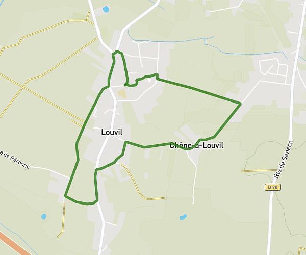
This running route covers 4.332mi starting from Marcq-en-Barœul, Nord. The run is a loop trail and returns to the trailhead. This run is rated as easy, expect about 1h to complete it. The route has an elevation gain of 157ft and an elevation loss of 157ft.
Mathias
Route details
4.33mph
Speed
686 kcal
Calories burned
Loop trail
Route type
62ft
Min altitude
128ft
Max altitude
Route profile
157ft
Elevation gain
157ft
Elevation loss
62ft
Min altitude
128ft
Max altitude
How to get there
Trailhead: Avenue Des Olympiades, 59700 Marcq-en-Barœul
GPS coordinates of the trailhead: 50.68643, 3.08914 / 50°41'11'' N, 3°5'20'' E