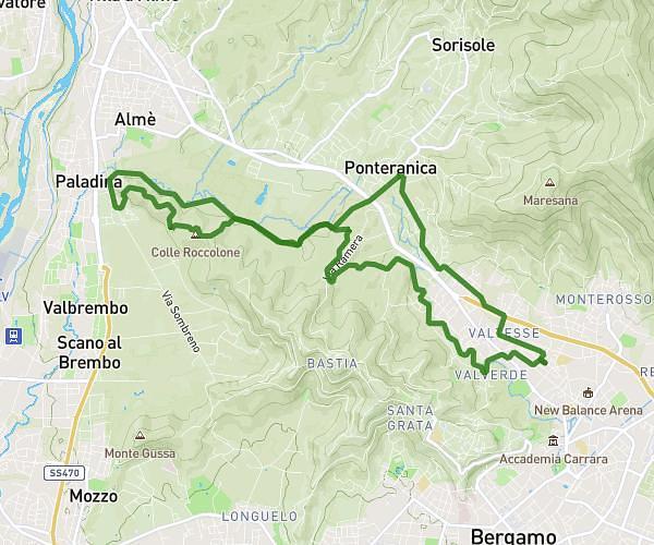
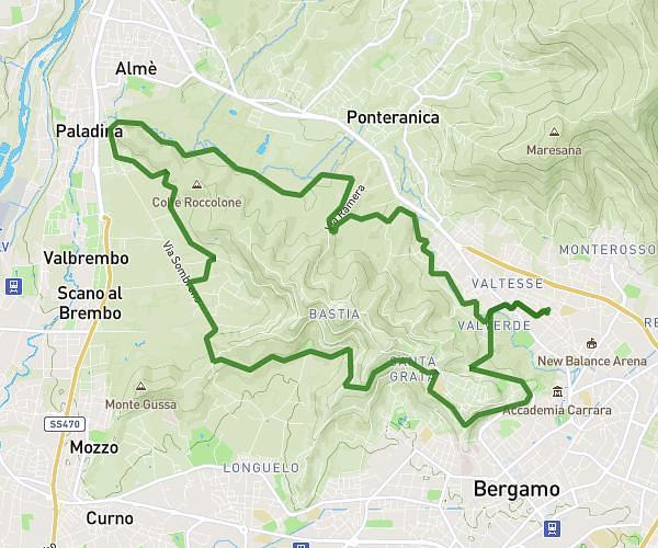
This running route covers 7.235mi starting from Bergamo, Bergamo. The run is a loop trail and returns to the trailhead. This run is rated as moderate, expect about 1h10m to complete it. The route has an elevation gain of 636ft and an elevation loss of 640ft.
Città alta e val Marina
Route details
6.2mph
Speed
800 kcal
Calories burned
Loop trail
Route type
863ft
Min altitude
1266ft
Max altitude
Route profile
636ft
Elevation gain
640ft
Elevation loss
863ft
Min altitude
1266ft
Max altitude
How to get there
Trailhead: Via Barnaba Vaerini 2, 24123 Bergamo Bergamo, Italy
GPS coordinates of the trailhead: 45.712576, 9.674568 / 45°42'45'' N, 9°40'28'' E