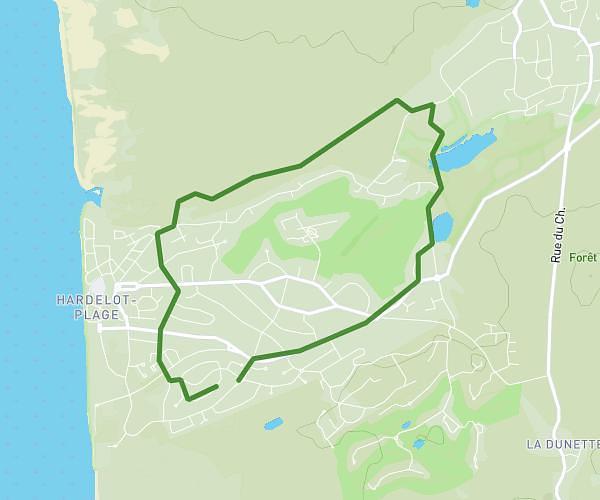
This running route covers 3.742mi starting from Condette, Pas-de-Calais. The run does not return to the trailhead and ends near Chemin Departemental 113, 62360 Condette, France. This run is rated as easy, expect about 54m to complete it. The route has an elevation gain of 259ft and an elevation loss of 279ft.
Condette
Route details
4.16mph
Speed
617 kcal
Calories burned
Point to point
Route type
66ft
Min altitude
108ft
Max altitude
Route profile
259ft
Elevation gain
279ft
Elevation loss
66ft
Min altitude
108ft
Max altitude
How to get there
Trailhead: 1 Rue De La Source, 62360 Condette, France
GPS coordinates of the trailhead: 50.645066, 1.611955 / 50°38'42'' N, 1°36'43'' E