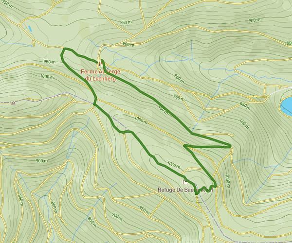
This hiking trail covers 10.554mi starting from Gérardmer, Vosges. The hike does not return to the trailhead and ends near Route Des Crêtes, 88250 Metzeral. This hike is rated as strenuous, plan for about 4h14m to complete it. The route has an elevation gain of 2267ft and an elevation loss of 1745ft.
étape 1 : tour de bresse
Route details
2.49mph
Speed
1904 kcal
Calories burned
7.2%
Avg grade
Point to point
Route type
3130ft
Min altitude
4442ft
Max altitude
Route profile
2267ft
Elevation gain
1745ft
Elevation loss
3130ft
Min altitude
4442ft
Max altitude
How to get there
Trailhead: Chemin De Derrière Le Haut, 88400 Gérardmer
GPS coordinates of the trailhead: 48.04162, 6.91301 / 48°2'29'' N, 6°54'46'' E