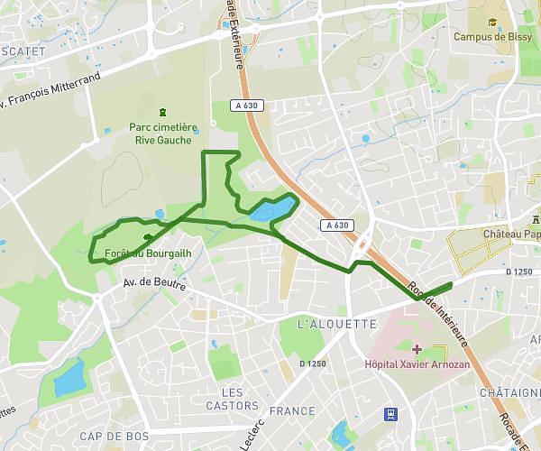
This walking route covers 1.56mi starting from Cubzac-les-Ponts, Gironde. The walk is a loop trail and returns to the trailhead. This walk is rated as easy, plan for about 33m to complete it. The route has an elevation gain of 118ft and an elevation loss of 118ft.
Balade 3
Route details
21:08/mi
Pace
135 kcal
Calories burned
Loop trail
Route type
33ft
Min altitude
112ft
Max altitude
Route profile
118ft
Elevation gain
118ft
Elevation loss
33ft
Min altitude
112ft
Max altitude
How to get there
Trailhead: Impasse De La Gare, 33240 Cubzac-les-Ponts
GPS coordinates of the trailhead: 44.97302, -0.45884 / 44°58'22'' N, 0°27'31'' W