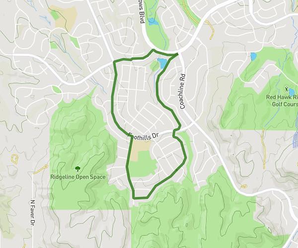
This running route covers 5.841mi starting from Westminster, Colorado. The run is a loop trail and returns to the trailhead. This run is rated as moderate, expect about 1h19m to complete it. The route has an elevation gain of 62ft and an elevation loss of 52ft.
5.84
Route details
4.44mph
Speed
903 kcal
Calories burned
Loop trail
Route type
5390ft
Min altitude
5453ft
Max altitude
Route profile
62ft
Elevation gain
52ft
Elevation loss
5390ft
Min altitude
5453ft
Max altitude
How to get there
Trailhead: Teller Street, Westminster, Colorado 80021, United States
GPS coordinates of the trailhead: 39.856103, -105.076705 / 39°51'21'' N, 105°4'36'' W