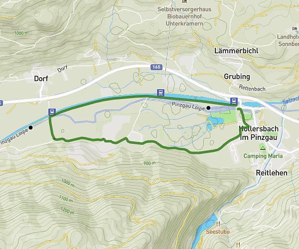
This running route covers 3.188mi starting from Hollersbach im Pinzgau, Salzburg. The run is a loop trail and returns to the trailhead. This run is rated as easy, expect about 34m to complete it. The route has an elevation gain of 236ft and an elevation loss of 240ft.
Hollersbach 5km
Route details
5.62mph
Speed
389 kcal
Calories burned
Loop trail
Route type
2618ft
Min altitude
2677ft
Max altitude
Route profile
236ft
Elevation gain
240ft
Elevation loss
2618ft
Min altitude
2677ft
Max altitude
How to get there
Trailhead: Hollersbach 154, 5731 Hollersbach im Pinzgau, Austria
GPS coordinates of the trailhead: 47.277921, 12.41623 / 47°16'40'' N, 12°24'58'' E