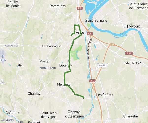
This running route covers 6.198mi starting from Lyon, Rhône. The run is a loop trail and returns to the trailhead. This run is rated as moderate, expect about 1h7m to complete it. The route has an elevation gain of 659ft and an elevation loss of 666ft.
Ryryryryryry
Route details
5.55mph
Speed
766 kcal
Calories burned
Loop trail
Route type
535ft
Min altitude
699ft
Max altitude
Route profile
659ft
Elevation gain
666ft
Elevation loss
535ft
Min altitude
699ft
Max altitude
How to get there
Trailhead: 36 Montée Saint Barthélémy, 69005 Lyon, France
GPS coordinates of the trailhead: 45.76276, 4.82532 / 45°45'45'' N, 4°49'31'' E