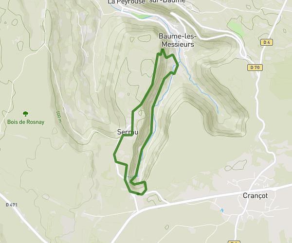
This walking route covers 7.315mi starting from Hauteroche, Jura. The walk is a loop trail and returns to the trailhead. This walk is rated as hard, plan for about 2h37m to complete it. The route has an elevation gain of 1506ft and an elevation loss of 1506ft.
Crancot baume
Route details
21:27/mi
Pace
641 kcal
Calories burned
Loop trail
Route type
1024ft
Min altitude
1729ft
Max altitude
Route profile
1506ft
Elevation gain
1506ft
Elevation loss
1024ft
Min altitude
1729ft
Max altitude
How to get there
Trailhead: 3 Rue Du Cressard, 39570 Hauteroche, France
GPS coordinates of the trailhead: 46.688344, 5.65897 / 46°41'18'' N, 5°39'32'' E