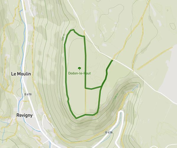
This walking route covers 2.923mi starting from Hauteroche, Jura. The walk is a loop trail and returns to the trailhead. This walk is rated as easy, plan for about 1h3m to complete it. The route has an elevation gain of 453ft and an elevation loss of 466ft.
Grange sur baumes
Route details
21:33/mi
Pace
257 kcal
Calories burned
Loop trail
Route type
1460ft
Min altitude
1647ft
Max altitude
Route profile
453ft
Elevation gain
466ft
Elevation loss
1460ft
Min altitude
1647ft
Max altitude
How to get there
Trailhead: 5 Place De L'église, 39570 Hauteroche, France
GPS coordinates of the trailhead: 46.713751, 5.644555 / 46°42'49'' N, 5°38'40'' E