MapPlanner
25.171mi
Distance
2h42m
Duration
9.32mph
Speed
+456ft
Elevation gain
-479ft
Elevation loss
Hard
Level

VTT Mirebel baume crancot

Route details

1424 kcal
Calories burned
0.7%
Avg grade
Loop trail
Route type
1539ft
Min altitude
1903ft
Max altitude

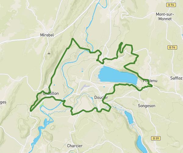
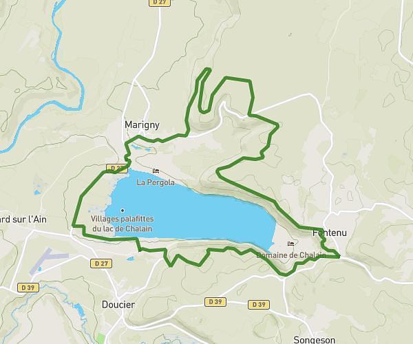
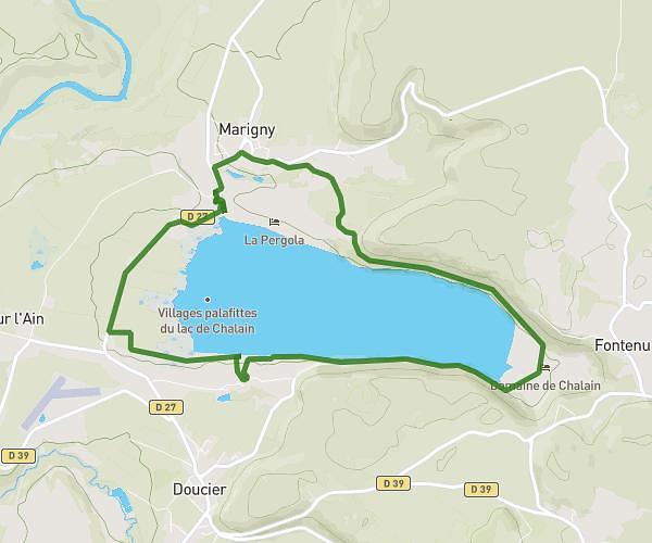
This cycling route covers 25.171mi starting from Hauteroche, Jura. The ride is a loop trail and returns to the trailhead. This route is rated as hard, plan for about 2h42m to complete it. The route has an elevation gain of 456ft and an elevation loss of 479ft.

Route profile

456ft
Elevation gain
479ft
Elevation loss
1539ft
Min altitude
1903ft
Max altitude

How to get there

Trailhead: 32 Rue De La Barette, 39570 Hauteroche, France

GPS coordinates of the trailhead: 46.69976, 5.72869 / 46°41'59'' N, 5°43'43'' E

Caution: May Cross Private Property

This route may pass through or near private property. Always respect posted signs, obtain permission where required, and follow local trespassing laws. MapPlanner does not guarantee public access along any route.

Safety Notice

Trail and road conditions may change without notice due to weather, construction, or other factors. Always verify current conditions before heading out. You are responsible for your own safety — follow local signage, obey traffic laws, and use your best judgment on the trail.