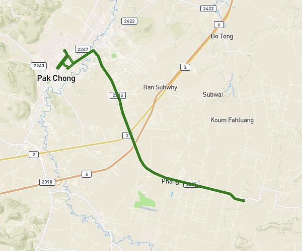
This cycling route covers 8.562mi starting from Pak Chong, Nakhon Ratchasima. The ride does not return to the trailhead and ends near นม.3118, 30130, Pak Chong, Nakhon Ratchasima, Thailand. This route is rated as easy, plan for about 30m to complete it. The route has an elevation gain of 85ft and an elevation loss of 89ft.
Home-phils
Route details
263 kcal
Calories burned
0.4%
Avg grade
Point to point
Route type
994ft
Min altitude
1079ft
Max altitude
Route profile
85ft
Elevation gain
89ft
Elevation loss
994ft
Min altitude
1079ft
Max altitude
How to get there
Trailhead: ถนนเทศบาล 27, 30130, Pak Chong, Nakhon Ratchasima, Thailand
GPS coordinates of the trailhead: 14.71942, 101.41788 / 14°43'9'' N, 101°25'4'' E