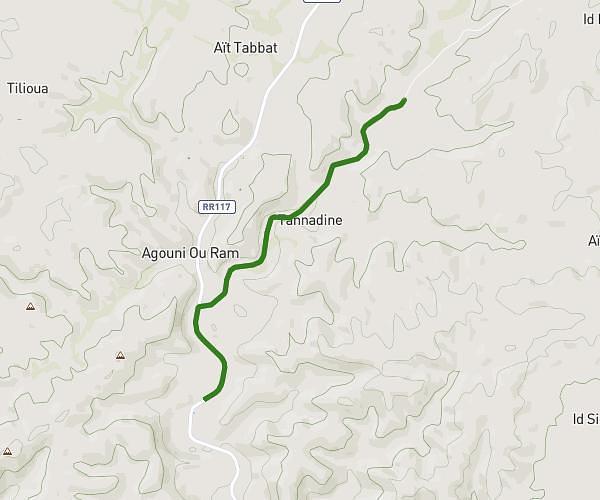
This running route covers 2.011mi starting from Tighirt, Guelmim-Oued Noun. The run does not return to the trailhead and ends near Rr117, 85 Tighirt, Morocco. This run is rated as easy, expect about 1h8s to complete it. The route has an elevation gain of 0ft and an elevation loss of 151ft.
6imo7md
Route details
2.01mph
Speed
688 kcal
Calories burned
Point to point
Route type
3842ft
Min altitude
3993ft
Max altitude
Route profile
0ft
Elevation gain
151ft
Elevation loss
3842ft
Min altitude
3993ft
Max altitude
How to get there
Trailhead: 85, Tizarharine, Tighirt, Guelmim-Oued Noun, Morocco
GPS coordinates of the trailhead: 29.33517, -9.42425 / 29°20'6'' N, 9°25'27'' W