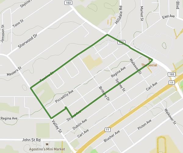
This walking route covers 2.071mi starting from Thunder Bay, Ontario. The walk is a loop trail and returns to the trailhead. This walk is rated as easy, plan for about 48m to complete it. The route has an elevation gain of 82ft and an elevation loss of 82ft.
Feb25
Route details
23:09/mi
Pace
196 kcal
Calories burned
Loop trail
Route type
781ft
Min altitude
843ft
Max altitude
Route profile
82ft
Elevation gain
82ft
Elevation loss
781ft
Min altitude
843ft
Max altitude
How to get there
Trailhead: Regina Avenue, P7B 5C2 Thunder Bay
GPS coordinates of the trailhead: 48.44742, -89.26519 / 48°26'50'' N, 89°15'54'' W