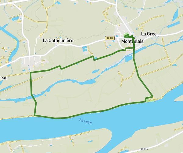
This running route covers 3.238mi starting from Ancenis-Saint-Géréon, Loire-Atlantique. The run is a loop trail and returns to the trailhead. This run is rated as easy, expect about 35m to complete it. The route has an elevation gain of 23ft and an elevation loss of 26ft.
course ville
Route details
5.55mph
Speed
400 kcal
Calories burned
Loop trail
Route type
66ft
Min altitude
89ft
Max altitude
Route profile
23ft
Elevation gain
26ft
Elevation loss
66ft
Min altitude
89ft
Max altitude
How to get there
Trailhead: 467 Rue Du Tertre, 44150 Ancenis-Saint-Géréon, France
GPS coordinates of the trailhead: 47.37802, -1.17911 / 47°22'40'' N, 1°10'44'' W