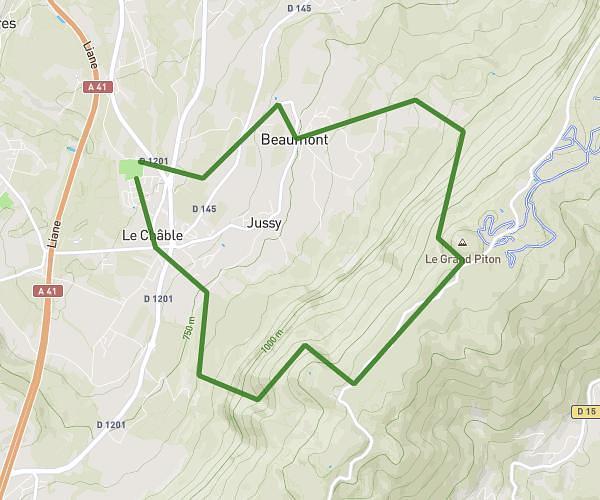
This running route covers 2.377mi starting from Bassy, Haute-Savoie. The run is a loop trail and returns to the trailhead. This run is rated as easy, expect about 25m30s to complete it. The route has an elevation gain of 318ft and an elevation loss of 318ft.
Jogging bassy
Route details
5.59mph
Speed
292 kcal
Calories burned
Loop trail
Route type
1122ft
Min altitude
1332ft
Max altitude
Route profile
318ft
Elevation gain
318ft
Elevation loss
1122ft
Min altitude
1332ft
Max altitude
How to get there
Trailhead: Route De Veytrens D'en Haut, 74910 Bassy
GPS coordinates of the trailhead: 45.99795, 5.82063 / 45°59'52'' N, 5°49'14'' E