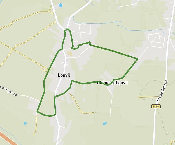
This running route covers 6.881mi starting from Attiches, Nord. The run is a loop trail and returns to the trailhead. This run is rated as moderate, expect about 1h6m to complete it. The route has an elevation gain of 66ft and an elevation loss of 75ft.
Pont a marcq avelin
Route details
6.26mph
Speed
755 kcal
Calories burned
Loop trail
Route type
125ft
Min altitude
200ft
Max altitude
Route profile
66ft
Elevation gain
75ft
Elevation loss
125ft
Min altitude
200ft
Max altitude
How to get there
Trailhead: Rue De La Neuville, 59551 Attiches
GPS coordinates of the trailhead: 50.51125, 3.059 / 50°30'40'' N, 3°3'32'' E