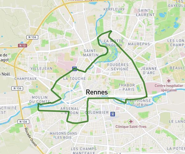
This running route covers 4.865mi starting from Rennes, Ille-et-Vilaine. The run is a loop trail and returns to the trailhead. This run is rated as easy, expect about 34m40s to complete it. The route has an elevation gain of 318ft and an elevation loss of 318ft.
Tempo Fougères-Assomp-Paris-Hoche-Sévigné
Route details
8.42mph
Speed
396 kcal
Calories burned
Loop trail
Route type
85ft
Min altitude
184ft
Max altitude
Route profile
318ft
Elevation gain
318ft
Elevation loss
85ft
Min altitude
184ft
Max altitude
How to get there
Trailhead: 5 Rue René Marcille, 35000 Rennes, France
GPS coordinates of the trailhead: 48.11195, -1.65743 / 48°6'43'' N, 1°39'26'' W