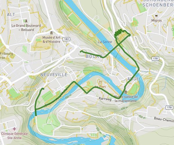
This walking route covers 5.954mi starting from Fribourg, Fribourg. The walk is a loop trail and returns to the trailhead. This walk is rated as hard, plan for about 1h35m to complete it. The route has an elevation gain of 1099ft and an elevation loss of 1096ft.
Entraînement Morat-Fribourg
Route details
15:58/mi
Pace
388 kcal
Calories burned
Loop trail
Route type
1745ft
Min altitude
2251ft
Max altitude
Route profile
1099ft
Elevation gain
1096ft
Elevation loss
1745ft
Min altitude
2251ft
Max altitude
How to get there
Trailhead: Rue Des Épouses 7, 1700 Fribourg, Switzerland
GPS coordinates of the trailhead: 46.80601, 7.16228 / 46°48'21'' N, 7°9'44'' E