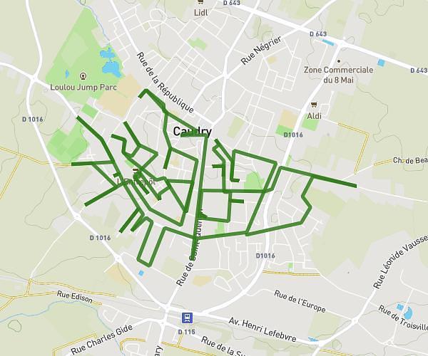
This running route covers 13.066mi starting from Denain, Nord. The run does not return to the trailhead and ends near 53 Rue Blaise Pascal, 59220 Denain, France. This run is rated as strenuous, expect about 5h9m to complete it. The route has an elevation gain of 344ft and an elevation loss of 322ft.
Denain1
Route details
2.54mph
Speed
3537 kcal
Calories burned
Point to point
Route type
79ft
Min altitude
141ft
Max altitude
Route profile
344ft
Elevation gain
322ft
Elevation loss
79ft
Min altitude
141ft
Max altitude
How to get there
Trailhead: 45 Rue Du Moulin, 59220 Denain, France
GPS coordinates of the trailhead: 50.326012, 3.395308 / 50°19'33'' N, 3°23'43'' E