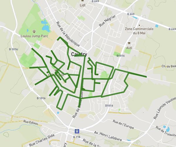
This running route covers 12.324mi starting from La Sentinelle, Nord. The run does not return to the trailhead and ends near Rue Des Vignes, 59174 La Sentinelle, France. This run is rated as strenuous, expect about 4h56m to complete it. The route has an elevation gain of 16ft and an elevation loss of 49ft.
la sentinelle
Route details
2.5mph
Speed
3384 kcal
Calories burned
Point to point
Route type
128ft
Min altitude
177ft
Max altitude
Route profile
16ft
Elevation gain
49ft
Elevation loss
128ft
Min altitude
177ft
Max altitude
How to get there
Trailhead: 937 Rue Gustave Delory, 59174 La Sentinelle, France
GPS coordinates of the trailhead: 50.352978, 3.46624 / 50°21'10'' N, 3°27'58'' E