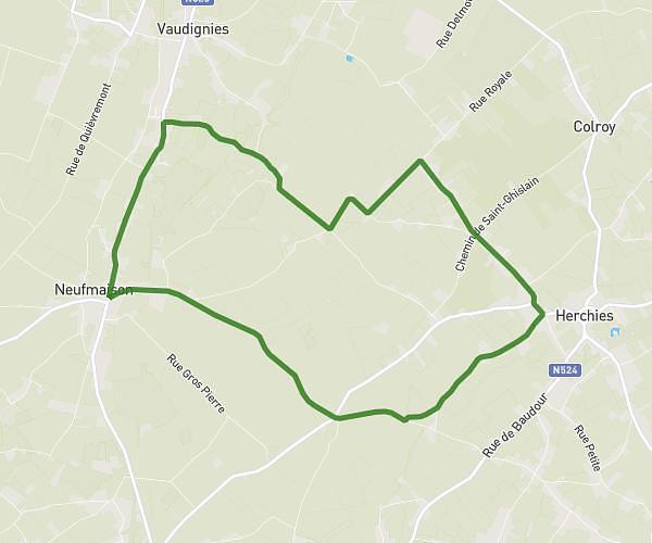
This running route covers 13.368mi starting from Marly, Nord. The run does not return to the trailhead and ends near 2 Rue Gérard Philippe, 59770 Marly, France. This run is rated as strenuous, expect about 4h51m to complete it. The route has an elevation gain of 322ft and an elevation loss of 371ft.
Marly
Route details
2.75mph
Speed
3332 kcal
Calories burned
Point to point
Route type
102ft
Min altitude
187ft
Max altitude
Route profile
322ft
Elevation gain
371ft
Elevation loss
102ft
Min altitude
187ft
Max altitude
How to get there
Trailhead: D 73, 59770 Marly, France
GPS coordinates of the trailhead: 50.337125, 3.553857 / 50°20'13'' N, 3°33'13'' E