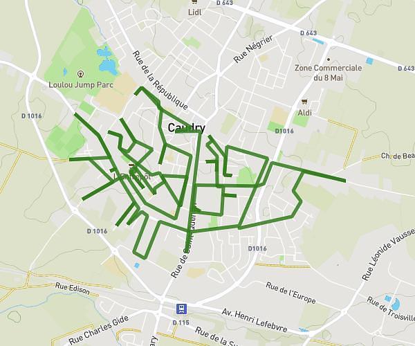
This running route covers 7.333mi starting from Prouvy, Nord. The run does not return to the trailhead and ends near 15 Résidence De L'enclos, 59121 Prouvy, France. This run is rated as moderate, expect about 2h57m to complete it. The route has an elevation gain of 541ft and an elevation loss of 479ft.
prouvy
Route details
2.49mph
Speed
2024 kcal
Calories burned
Point to point
Route type
82ft
Min altitude
154ft
Max altitude
Route profile
541ft
Elevation gain
479ft
Elevation loss
82ft
Min altitude
154ft
Max altitude
How to get there
Trailhead: 75 Rue De La Gare, 59121 Prouvy, France
GPS coordinates of the trailhead: 50.31553, 3.454913 / 50°18'55'' N, 3°27'17'' E