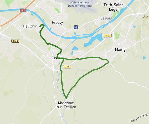
This running route covers 7.944mi starting from Thiant, Nord. The run does not return to the trailhead and ends near 36 Cité Sirot, 59224 Thiant, France. This run is rated as hard, expect about 3h11m to complete it. The route has an elevation gain of 407ft and an elevation loss of 387ft.
thiant
Route details
2.49mph
Speed
2192 kcal
Calories burned
Point to point
Route type
82ft
Min altitude
144ft
Max altitude
Route profile
407ft
Elevation gain
387ft
Elevation loss
82ft
Min altitude
144ft
Max altitude
How to get there
Trailhead: 35 Rue Roger Salengro, 59224 Thiant, France
GPS coordinates of the trailhead: 50.304135, 3.461299 / 50°18'14'' N, 3°27'40'' E