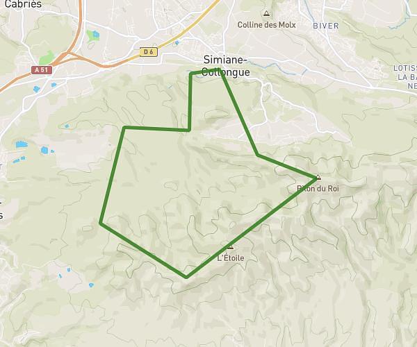
This running route covers 6.184mi starting from Aix-en-Provence, Bouches-du-Rhône. The run is a loop trail and returns to the trailhead. This run is rated as moderate, expect about 1h6m to complete it. The route has an elevation gain of 154ft and an elevation loss of 154ft.
10k
Route details
5.62mph
Speed
755 kcal
Calories burned
Loop trail
Route type
456ft
Min altitude
610ft
Max altitude
Route profile
154ft
Elevation gain
154ft
Elevation loss
456ft
Min altitude
610ft
Max altitude
How to get there
Trailhead: 1 Rue Du Docteur Lucien Cartotto, 13090 Aix-en-Provence, France
GPS coordinates of the trailhead: 43.51349, 5.43888 / 43°30'48'' N, 5°26'19'' E