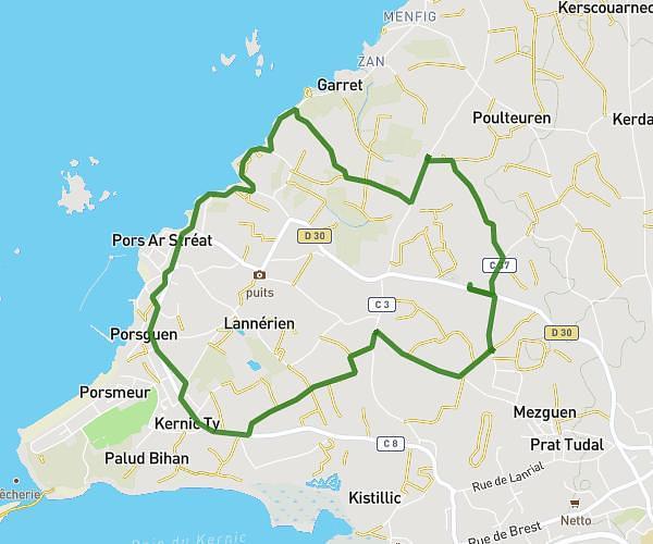
This running route covers 3.379mi starting from Plourin-lès-Morlaix, Finistère. The run is a loop trail and returns to the trailhead. This run is rated as easy, expect about 40m to complete it. The route has an elevation gain of 200ft and an elevation loss of 200ft.
Chemin vert
Route details
5.07mph
Speed
457 kcal
Calories burned
Loop trail
Route type
299ft
Min altitude
413ft
Max altitude
Route profile
200ft
Elevation gain
200ft
Elevation loss
299ft
Min altitude
413ft
Max altitude
How to get there
Trailhead: 295 Plateau Saint Fiacre, 29600 Plourin-lès-Morlaix, France
GPS coordinates of the trailhead: 48.56106, -3.82218 / 48°33'39'' N, 3°49'19'' W