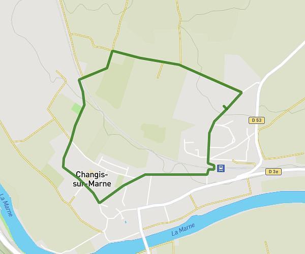
This walking route covers 4.637mi starting from Changis-sur-Marne, Seine-et-Marne. The walk is a loop trail and returns to the trailhead. This walk is rated as moderate, plan for about 1h39m to complete it. The route has an elevation gain of 210ft and an elevation loss of 210ft.
les lacs
Route details
21:22/mi
Pace
404 kcal
Calories burned
Loop trail
Route type
148ft
Min altitude
279ft
Max altitude
Route profile
210ft
Elevation gain
210ft
Elevation loss
148ft
Min altitude
279ft
Max altitude
How to get there
Trailhead: 31 Rue Marcel Neyrat, 77660 Changis-sur-Marne, France
GPS coordinates of the trailhead: 48.96167, 3.0242 / 48°57'42'' N, 3°1'27'' E