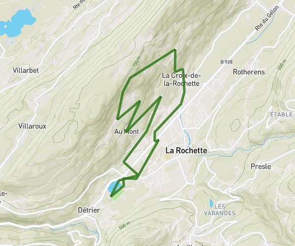
This running route covers 2.412mi starting from Chambéry, Savoie. The run is a loop trail and returns to the trailhead. This run is rated as easy, expect about 25m to complete it. The route has an elevation gain of 295ft and an elevation loss of 295ft.
course matinal
Route details
5.79mph
Speed
286 kcal
Calories burned
Loop trail
Route type
961ft
Min altitude
1201ft
Max altitude
Route profile
295ft
Elevation gain
295ft
Elevation loss
961ft
Min altitude
1201ft
Max altitude
How to get there
Trailhead: 455 Boulevard Massenet, 73000 Chambéry, France
GPS coordinates of the trailhead: 45.56225, 5.91796 / 45°33'44'' N, 5°55'4'' E