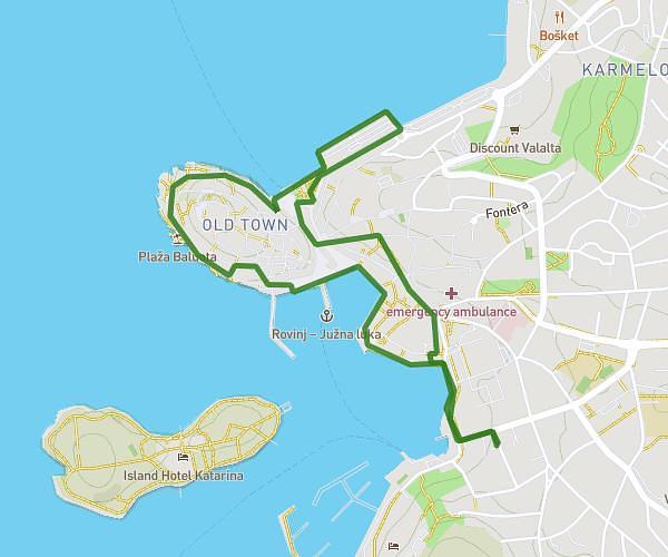
This walking route covers 1.579mi starting from Rovinj, Istria. The walk is a loop trail and returns to the trailhead. This walk is rated as easy, plan for about 1h30m to complete it. The route has an elevation gain of 207ft and an elevation loss of 207ft.
Rovinj 2nd walk 1st day
Route details
57:08/mi
Pace
368 kcal
Calories burned
Loop trail
Route type
-7ft
Min altitude
43ft
Max altitude
Route profile
207ft
Elevation gain
207ft
Elevation loss
-7ft
Min altitude
43ft
Max altitude
How to get there
Trailhead: Laginjina Ulica, 52210 Rovinj
GPS coordinates of the trailhead: 45.07787, 13.64032 / 45°4'40'' N, 13°38'25'' E