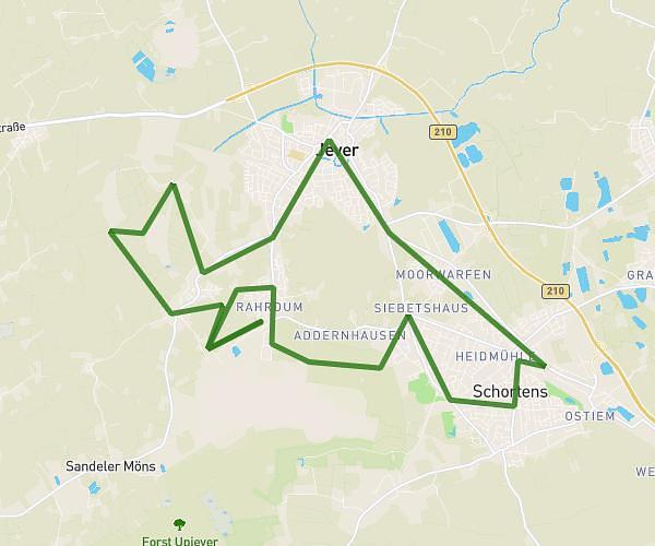
This running route covers 5.904mi starting from Jever, Lower Saxony. The run is a loop trail and returns to the trailhead. This run is rated as moderate, expect about 1h3m to complete it. The route has an elevation gain of 10ft and an elevation loss of 10ft.
GAL-FTZ
Route details
5.62mph
Speed
720 kcal
Calories burned
Loop trail
Route type
-7ft
Min altitude
3ft
Max altitude
Route profile
10ft
Elevation gain
10ft
Elevation loss
-7ft
Min altitude
3ft
Max altitude
How to get there
Trailhead: Wangerländische Straße 40, 26441 Jever, Germany
GPS coordinates of the trailhead: 53.579478, 7.909157 / 53°34'46'' N, 7°54'32'' E