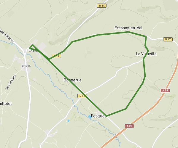
This running route covers 3.506mi starting from Montérolier, Seine-Maritime. The run is a loop trail and returns to the trailhead. This run is rated as easy, expect about 42m18s to complete it. The route has an elevation gain of 108ft and an elevation loss of 108ft.
La fresnaye - 5.6Km - Catherine
Route details
4.97mph
Speed
484 kcal
Calories burned
Loop trail
Route type
614ft
Min altitude
669ft
Max altitude
Route profile
108ft
Elevation gain
108ft
Elevation loss
614ft
Min altitude
669ft
Max altitude
How to get there
Trailhead: Route Des Murs, 76680 Montérolier
GPS coordinates of the trailhead: 49.60491, 1.33128 / 49°36'17'' N, 1°19'52'' E