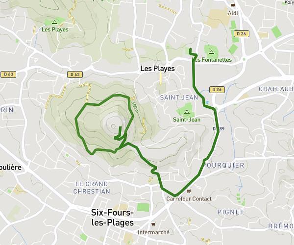
This running route covers 4.763mi starting from Sanary-sur-Mer, Var. The run is a loop trail and returns to the trailhead. This run is rated as easy, expect about 45m to complete it. The route has an elevation gain of 367ft and an elevation loss of 390ft.
Sanary 7.5
Route details
6.35mph
Speed
515 kcal
Calories burned
Loop trail
Route type
59ft
Min altitude
308ft
Max altitude
Route profile
367ft
Elevation gain
390ft
Elevation loss
59ft
Min altitude
308ft
Max altitude
How to get there
Trailhead: 119a Impasse De La Santoline, 83110 Sanary-sur-Mer, France
GPS coordinates of the trailhead: 43.13635, 5.81429 / 43°8'10'' N, 5°48'51'' E