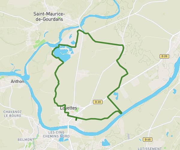
Explore this cycling route of 22.1km starting from Crémieu, Isère. The ride is a loop and returns to the starting point. This route has no defined difficulty level, plan for about 2h12m to complete it. The route has a positive elevation gain of 165m and a negative elevation loss of 166m.
22100m
Route details
Route profile
165m
Elevation +
166m
Elevation -
224m
Min altitude
279m
Max altitude
How to get there
Route starting point: Rue Du Lieutenant Théodose Morel, 38460 Crémieu
GPS coordinates of the starting point: 45.72155, 5.24952 / 45°43'17'' N, 5°14'58'' E
Calculate the time to reach the starting point from your location or an address